
Iceland is shown on some of the major medieval maps, but it first appears on the so-called Anglo-Saxon map from around the year 1000. The most significant version of Iceland on maps from this period is on Carta Marina by Olaus Magnus in 1539.

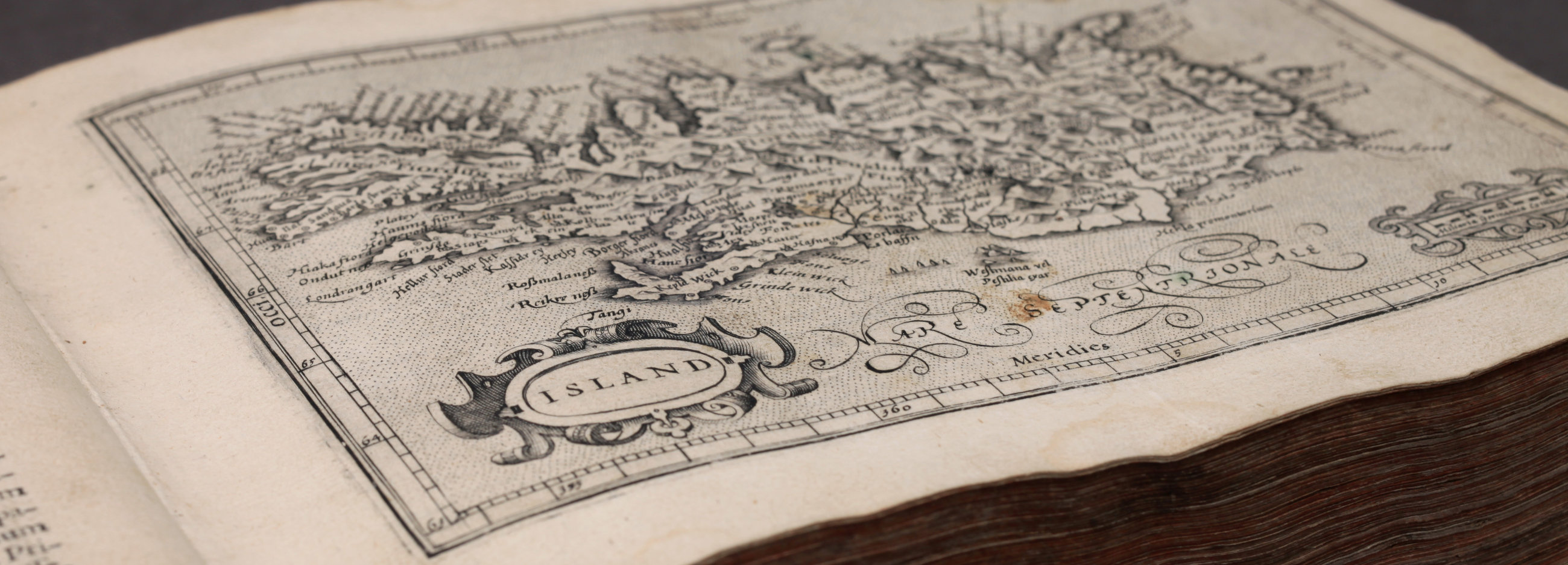
Bishop Gudbrandur Thorláksson‘s map has not been preserved but versions of it by the cartographers Ortelius, Mercator and Carolus formed the basis of the vast majority of Iceland maps for more than a century.

For a long time makers of nautical charts paid very little attention to Iceland but interest grew with the increased influx of foreign fishermen to Icelandic waters.

Norwegian surveyors were sent to Iceland under the command of Th. H. H. Knoff. The results of their measurements were shown on maps that appeared in Horrebow's book in 1752 and in Nuremberg in 1761. These maps became a model for many Iceland maps until the 19th century.

The French government undertook a major scientific expedition to the North Atlantic under the leadership of Verdun de la Crenne. A new version of Iceland appears on a map in a book by members of the expedition. The two versions, Knoff and Verdun de la Crenne, were for a long time rivals for acceptance and for a while the latter had the best of it.

A captain in the service of the trading company, Hans Erik Minor, was sent to Iceland. His task was to survey all the coasts and harbours. He charted Faxaflói including Reykjanes and Snæfellsnes. At the same time the sea captain J. P. Wleugel surveyed the Eastern Fiords, from Hornafjördur to Borgarfjördur.

After Minor and Wleugel, there was a break in coastal surveys for a while but in the beginning of the 19th century, work resumed and it was mainly Norwegian captains who were involved in the project. The maps were then published by Poul de Løvenørn, who was director of the Danish Hydrographic Office.

Björn Gunnlaugsson was entrusted to make a map of Iceland and worked on the survey during the years 1831-1843. His measurements and mapping were a great scientific achievement. For the first time, a decent map of the whole country was available and it became the basis for other map makers for more than half a century.

Thorvaldur Thoroddsen travelled around almost all of Iceland in 1882-1898. In 1900 he published a new complete map of the country in two sheets where he compiles his adjustments and appendixes and adapts them to Björn Gunnlaugsson’s map. A year later his Geological Map of Iceland was published.

Hansen and Bruun made special maps of Iceland at the turn of the 20th century.

At the beginning of the century, officers from the geodetic section of the Danish General Staff were sent to Iceland by the government in Denmark. The results of their survey were 117 topographic maps of about one third of the country or the western and southern parts. In the years 1919 and 1920, the Danish surveyors started the work again and later the Danish Geodetic Institute took over from the General Staff and in 1944 it finished printing a map covering the whole country on 87 sheets. The U.S. Army Map Service took aerial photographs of all Iceland in the years 1945-1946 and published a map based on them on 297 sheets. Many of the place names and other information was taken from the Danish maps of the years before.

A few maps of Reykjavik from the 18th century to the turn of the 20th century.

Maps who do not belong to the other categories.